

Kidman’s Hut was constructed in March 1932 by Alec and Ken Kidman, and Bill Napthali as a shelter for stockmen working the Kidman’s snowlease. The Kidmans grazed stock here during the summer months from the early 1900s until 1945, with the Miners family taking over the lease until 1958 — when all grazing above 1370m was terminated.
The Burrungubugge River valley was first grazed and mined for gold in the mid-late 19th century. It was part of the Murryang or Munyang squatting run, which extended along the main range from south of the Bulls Peaks to Mt Kosciuszko. Stock were brought from Snowy Plain over Brassy Gap into the valley, then pushed out onto the alpine pastures of the main range.
Gold miners followed the Brassy Gap route on their way to the Toolong Diggings in 1893 and the Bogong Diggings and Grey Mare Mine from 1895 through to the 1930s, travelling via the Bulls Peaks and Strumbo Hill. Sometime between 1860 and 1890 a section of the river just west of Kidman’s Hut was worked by miners; known as MacDonald’s Diggings.
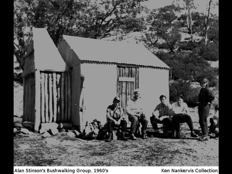
From 1920-60 the Brassy Gap route was the main way by which bushwalkers and skiers could access the main range from Whites River to Mt Jagungal. Kidman’s was an important staging post, with Cesjacks, Mawsons, Alpine and Tin Huts all being within a half-day’s skiing, Whites River and Grey Mare Huts within a days’ ski. Construction of the Schlink Pass and Cabramurra-Khancoban Roads c1958-60 transformed backcountry access and the Burrungubugge valley and its huts became less-trafficked.
Kidmans Hut – Background
Graziers were running stock along the main range north of the Snowy River by the mid-19th century. By 1870 this area was known as the Murryang Run (aka Munyang) and shepherd camps are recorded in the vicinity of Dicky Cooper Creek, and the route from Snowy Plain over Brassy Gap and past Kidman’s location up onto the main range was already being used to shift stock up to summer runs on the alpine pasture. This route was also being travelled by early trekkers riding to ‘the summit’ via the Rolling Ground—Tate—Twynan—Carruthers peaks.
For 100 years, this route through Brassy Gap would be the primary access onto the main range from Whites River to Mt Jagungal. Bridle tracks headed off from the future location of Kidmans Hut; northwest up the Bulls Peaks, before crossing to Strumbo Hill and then going on to the Toolong Run (now Tooma Reservoir) and through to the Upper Murray, westward over to the pastures of the Valentine and Dicky Cooper valleys, and southwest onto the pastures of the Brassy Mountains and Finns River.
In the 1890s, miners to the Toolong and Bogong diggings likely travelled this route, which had developed into a dray track to the Grey Mare mine by 1898. The first crushing plant and supplies were taken into Grey Mare via this route, and it remained the main access track to the mine until the current Grey Mare Trail was extended from Farm Ridge in the mid-1930s. One of the gullies between the Bulls Peaks and Strumbo reportedly contains abandoned mining equipment from the 1890s however the exact location is unrecorded. In the 1980s a row of crude timber snow poles was still evident across a saddle on the Bulls Peaks range marking this track.
At some time between the 1860s and 1890s the upper Burrungubugge River 1-1.5km west of the current hut was mined for gold. Both the diggings and this section of river taking the name MacDonald — probably after an early miner. Charlie Bell suggested the Kidman family also mined gold here prior to or during their time grazing stock in the valley.
The upper Burrungubugge valley was probably open to scrub or snow lease during the late 19th and early 20th centuries, but details are unclear. Between 1914 and 1918 James Dudley Kidman from Paupong on the Lower Snowy purchased two freehold lots and a conditional lease (Lots 8, 9, 10) covering 960 acres south of the current hut. This strongly suggests he was consolidating a previous interest — ie a lease over the wider valley. Whilst the Kidmans are suspected of leasing the valley from around the turn of the century, the first lease recorded on Lands Dept maps dates from 1929, when James’ brother Alexander James (Alec) Kidman acquired snowlease block E1 of 2150 acres surrounding Lots 8-10.
Kidmans Hut was built in March 1932 by Alec Kidman, Bill Napthali and James Kidman’s son, Ken, on Alec’s block E1. Bill, son of Maurice and Sarah Napthali of Snowy Plains House (just south of Daveys Hut) was related to the Kidmans — James being married to Eliza Napthali. They cut all the timber for the wall frame and some of the roof rafters from woodland across the creek. Squared timber for the main end rafters was salvaged from an old shed at Napthali's house. Stones for the fireplace were retrieved from the creek. Floorboards intended for the hut were stacked on Napthali’s verandah for many years — they never made it into the hut, which retains a tamped earth floor to this day. Bill used a draught horse and primitive sled made from a forked bough to drag all the material including the roofing iron to the hut.
Ken Kidman recalled building the hut just prior to the autumn muster to take the stock out of the mountains for the winter. “It was the wettest bloody camp I ever had, Alec and I camped there for four days in the tent. On the third day I decided to build a bit of a galley, so I got four sheets of iron and stuck them on four forky sticks. That was the best shelter we ever had”.
A small set of yards was constructed uphill of the hut, whilst a large fenced horse paddock was created around the hut.
Gilder noted in the Australian Ski Yearbook of 1935 that Kidmans Hut could provide safety for skiers caught east of the Main Range in bad weather but did not promote it as a destination or place to stay. Of diminutive size, with a floor or earth, no window and limited furniture, the hut has always been one of the most basic in the mountains, however the hut was immortalised in the 1970s anecdote of a party arriving in a blizzard one evening whereupon one member looked around the crude interior and remarked that ‘no matter how good a tent was, it would never provide as good a shelter as the most primitive hut.’
Alec Kidman retained the snowlease through the 1930s. In 1939 the Alpine Hut Club Company negotiated acquisition of 40 acres of James Kidman’s Lot 10. On the new Lot 11 they constructed the Alpine Hut — a large backcountry ski lodge — after constructing a rough vehicle track from Kidmans into the site on Dead Horse Creek. Alpine catered for club members and paying guests, with a resident cook during the winter months. The subdivision was not confirmed until 1942.
In 1943 the Lands Dept established a new snow lease system across the mountains and Alec, James & EW Kidman along with VR Power took up Block E1 incorporating Kidmans Hut. James Kidman died in 1943, following which his two freehold lots were sold to HR Scarlett.
In 1945 the Kidmans surrendered their lease over E1, which was taken up by WA Miners & JB Fraser, and renewed in 1950. Ron, Leon and Brett Miners ran stock on the lease and used the hut until grazing was discontinued above 4500’ (1370m) in 1958.
Through the 1930s and early 1950s the route from Snowy Plain past Kidmans and up onto the range around Mt Jagungal was increasingly used by walkers and skiers. From Kidmans skiers had the option of a half-day ski to either Cesjacks, Mawsons, Alpine or Tin Huts, Whites River and Grey Mare Huts within a days’ ski. Both Alpine Hut and the Exclusive Squirrels Club, who set up Mawsons as a ski-touring base during the 1950s, brought all their supplies in via the rough track over Brassy Gap past Kidmans. In the summers, the Squirrels would leave material at Kidmans and then sled it over the range once there was snow cover. Nell Chaffer recalled sacks of flour and blocks of cheese intended for Alpine being abandoned at Kidmans, when the track above had become impassable due to mud or snow.
By the early 1950s Alpine Hut had become unviable in the face of main range developments and the Hut was surrendered to the Kosciusko State Park Trust in 1954. Kidmans remained a staging post for skiing the Jagungal area until the Schlink Pass Road was constructed in1960. The vehicle track over Brassy Gap was closed following the formation of the Kosciusko National Park; Alpine and Kidmans Huts were retained as public shelter huts. In 1979, Alpine Hut burned down due to an escaping internal fire.
Kidmans Hut remains a popular recreational hut for walking loops out of Daveys Hut on Snowy Plain through the Burrungubugge valley. The track over Brassy Gap is now quite vague in places, and the routes onto the main range are quite scrubby, although there are traces and residual cairns up the spur above MacDonalds diggings.
Documentary Sources
Downing, Pauline: Huts and Homesteads of Kosciuszko National Park, P Downing 2010
Hueneke, Huts of the High Country, ANU Press 1982; People of the Australian High Country, Tabletop Press 1994.
KHA records, database and images.
Lamble, Tim: Jagungal & Brassy Mts Ski Touring Map Ed 3 1983
NSW Dept of Land and Property Information: parish maps c1880s-1970 (Munyang), snow lease plans 1931-68.
NSW Dept Mines: Geological Survey Plan Gungarlin-Burrungubugge Rivers 1951.
Some Nearby Points of Interest
Brassy gap track through to Snowy Plain and Daveys Hut. Overgrown but traces evident along much of route.
MacDonalds diggings along the river 1-1.5km west of the hut, below and above a narrow gorge. Scrubby but clearing at uppermost part of diggings.
Old stockmans camp and stone cairns marking old route up spur towards Mawsons, heading up south side of River from upper diggings 1.5km west of hut. Scrubby.
Alpine Hut site on dead horse creek. Possibly some surface remains in small clearing on dead horse creek. Scrubby.
Amenity
Water – in creek 20m to northeast. High flow, never dry.
Toileting – no pit toilet. Go some distance to south or west away from the hut & creek.
Firewood – woodland 200m to west.
Emergency Information
Nearest Phone Reception Point in an Emergency - ????
Nearest Trackhead/Public Road – Gungarlin River Bridge on the Gungarlin Powerline Rd, ~11 km (3hr walk) via Brassy Gap and Daveys Hut; or Snowy River Bridge near Island Bend on the Gungarlin Powerline Rd, ~12 km (3.5 hr walk) down the Burrungubugge Valley. Traffic very occasional on both. Guthega Road is additional ~4km (1 hr) on from Snowy River Bridge; more regular but still only light traffic.